July 15, 2013
Polar Crater Hopping

image by " rel="nofollow Avani Soares, Canoas, Brazil
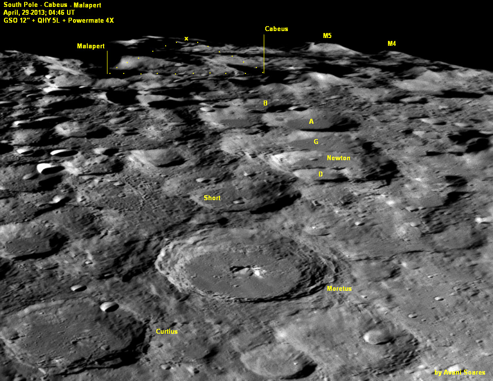
The image shows the south polar region of the Moon during an observation made on April 29, 2013, taking advantage of a favorable libration in latitude. A classic exercise when observing a region like this is trying to figure out the name of the craters that appear there. Let's start by Curtius in the lower left, then jump to Moretus, the crater located in the center of the image, with its bright central peak. A little beyond is Short, and a little to the right is Newton and Newton D, G, A and B. A little further, almost in limbo is Cabeus, and, emerging from the limbus, one can see two peaks of mountains known as M4 and M5. Also interesting to note is Malapert because if we triangulate an imaginary (dotted) line with Cabeus, at the other end of the triangle is the exact position of the Lunar South Pole (marked by x). This technique should be called "Crater Hopping" and could be used more often by lunar observers who want to be located accurately.
" rel="nofollow Avani Soares
NOTE: Online Virtual Lunar Science Conference begins TOMORROW at 8:30 AM with talks by science leaders: " rel="nofollow http://lunarscience.nasa.gov/LSF2013/
(It is free!)
Technical Details
April 29, 2013,. Newtonian GSO 12" f/5 with camera Qhy 5L and Powermate Tele Vue 4X. Stacking 61 frames using the AS! 2.
Related Links
21st Century Atlas chart L4.


