May 11, 2008
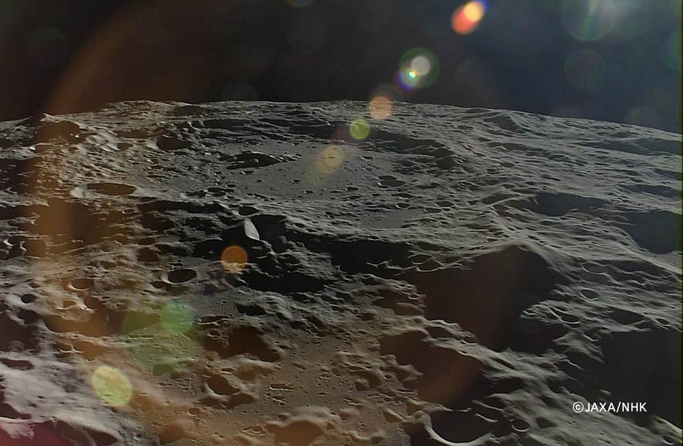
Volcano M3?

image by Kaguya HDTV courtesy of JAXA/NHK
If this were a picture of Earth, or even Mars or Venus, there would be no qualms about describing the pit-topped peak at the right as a volcano. But the Moon never produced large steep-sided volcanoes so we look for other explanations. In fact, this peak is relatively well known to polar aficionados, and it has a designation - it is M3, named by Ewen Whitaker 50 years ago. More recently, it was realized that M3 and other peaks seen in projection along the south polar area limb (named Leibnitz Mountains by Schröter) mark the rim of the giant South Pole-Aitken impact basin. So as a basin rim this should be a piece of uplifted crust, perhaps coated with SPA ejecta. But it sure looks like a conical volcano. Accepting the basin rim peak theory, the pit is just a random impact, being on the mountain top only by accident. I accept the theory, but am uncomfortable with it... Oh yes, the large crater near the top of the image is Drygalski.
Chuck Wood
Technical Details
Ignore - or enjoy - all the colorful internal reflections caused by the camera looking in the general direction of the Sun.
Note: Once again this Wikispace program has changed the brightness of the image compared to my processing in Photoshop - this looks muddy with no pure whites. I wish computers worked the way I think they should.
Related Links
Rükl plate VI
Yesterday's LPOD: Before Kaguya
Tomorrow's LPOD: Panoramic Sweep of Delicate Details
COMMENTS
(1) Does the upload compress the images?
JAXA-NHK 20m res HDTV still certainly whet the appetite for LRO's 0.5m resolution. Spotting Malapert in the orbital images, about which so much has been written, has always been easy because of the distinctive km wide impact on its high point; a little identifying signature at most, but not all angles. Perhaps it's best these images are being released at such a slow pace (anyone heard from Chang'e I lately?) because we get to "moon" over them that much longer. JCR
(2) A nice recent picture of M3 as see in projection from Earth (roughly in the sunward direction, from upper right in th Kaguya view) can be seen here where it was part of an internet discussion.
I wonder if anyone reading this has access to Schröter's books? If he gave timed and dated sketches, it would probably be possible to determine exactly which peaks would have been seen in projection on the limb at that time -- and hence which were his Leibnitz Alpha, etc (Whitaker identified all but Alpha, but seems to have been going more by the later IAU maps than by Schröter's originals). The peaks in the distance in the upper left (the farthest is probably between Boltzmann and Hausen) are likely part of his Doerfel Range. Again, Schröter's sketches (if they survive) would probably reveal exactly which peaks he named (Whitaker did not attempt to identify any of these, since they were in shadow in the photos he studied).
-  JimMosher
(3) Chuck--I've noticed that the "muddy" appearance and lack of pure whites only seems to happen with the JAXA images. Other daily LPODs and images from the LPOD Index look fine on my computer. It's a mystery. (??)
--Bill
COMMENTS?
Register, Log in, and join in the comments.


