Difference between revisions of "November 1, 2010"
| Line 20: | Line 20: | ||
<br /> | <br /> | ||
<hr /> | <hr /> | ||
| − | < | + | <div>You can support LPOD when you buy any book from Amazon thru [http://www.lpod.org/?page_id=591 LPOD!]<br /> |
| − | |||
| − | |||
| − | |||
| − | |||
| − | |||
| − | |||
| − | |||
| − | |||
| − | |||
| − | You can support LPOD when you buy any book from Amazon thru [http://www.lpod.org/?page_id=591 LPOD!]<br / | ||
| − | |||
| − | |||
| − | |||
</div> | </div> | ||
Revision as of 22:30, 2 January 2015
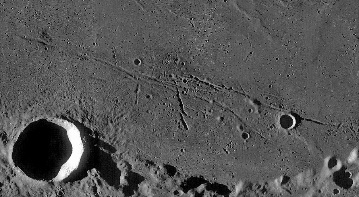
Remnant Oldness

WAC mosaic processed by John Moore, Ireland
Look what I stumbled upon in the Moon Wiki (which now has 3210 pages!). John has been processing multiple Wide Angle Camera images
using Jim Mosher's LROC WAC Previewer software. This shows the island of old mare on the southern edge of Mare Serenitatis, with
younger lavas to the north. The island of lava is clearly older as is indicated by its higher number of impact craters. It is also heavily crossed by
two families of rilles. The Menelaus Rilles that parallel the basin shoreline were formed due to subsidence of the center of the basin from the
weight of the mare lavas that fill it. The two or three rilles at about a 60° angle from the concentric ones may be secondary crater chains
for they seem to be made up of overlapping pits. Finally, at top left a rille cuts through the middle of a low hill. From telescopic images this
was interpreted to be a dome. But now is looks more like a random high spot - a piece of the larger elevated area to the east.
Chuck Wood
Related Links
Rükl plate 24
COMMENTS?
Click on this icon File:PostIcon.jpg at the upper right to post a comment.


