January 6, 2004
Gores of the Moon
|
|
|
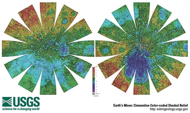
Gores of the Moon No, this isn't where old presidential candidates retire. This colorful, flowerlike image shows lunar gores - flat map pieces that can be cut out and pasted on a sphere to make a Moon globe. The colors depict topography, based on laser altimetry measures from the Clementine spacecraft. Reds denote areas higher than the average lunar elevation (no sea level to measure from) and blues and purples, the deepest depressions. Almost all of the reds are on the lunar far side - the crust there stands higher for some reason. The large patch of purple on the right image is the South Pole-Aitken Basin (or more colorfully, the Big Backside Basin) - the largest (2500 km wide) and deepest (12 km) hole in the solar system. You can explore the Moon's topography yourself by downloading this image as a large PDF file from the link below, printing it out and gluing it to a beachball. We have the US Geological Survey in Flagstaff, AZ to thank for this marvelous free resource! Related Links:
Yesterday's LPOD: South Polar Wilderness Tomorrow's LPOD: Petavius: Rilles & Volcanic Spots |
Author & Editor:
Charles A. Wood
COMMENTS?
Register, Log in, and join in the comments.


