March 27, 2005
New Lunar Maps!
Image Credit: Ralph Aeschliman |
|
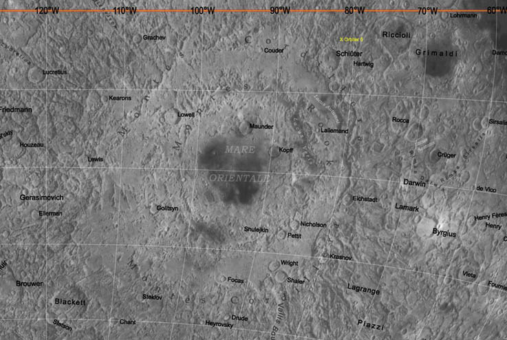
New Lunar Maps! Have you been observing Orientale during this favorable libration? Have you had trouble identifying craters and basin rings in this limb-scrunched region? If so, here is a map that can help you. This is a piece of a new lunar map of the hemisphere centered at 120 degrees West longitude. This farside perspective opens Orientale up, clearly showing the locations of limb-hugging craters Kopff, Maunder, Nicholson and Pettit. This is just one of four new lunar maps released by Ralph Aeschliman. The other new maps are one centered on the 120 degree East meridian, a full nearside map, and a map centered near the 90 degree West limb. These maps should look very familiar because they are basically updates of US Geological Survey air-brush maps that Ralph help draw when he worked for the Survey in the 1990s. His web site also includes wonderful new maps of Venus and of Mars, including the Spirit and Opportunity landing sites. Ralph comments that when he started mapping with the USGS in 1990 it required a room-full of equipment and multiple people, now he does it alone on a single computer on the dinette table on his boat! Related Links: Yesterday's LPOD: A Long Crater Tomorrow's LPOD: Hungarian Moon |
|
Author & Editor: |
COMMENTS?
Register, Log in, and join in the comments.


