February 16, 2009
14 Rilles, not Counting Gassendi

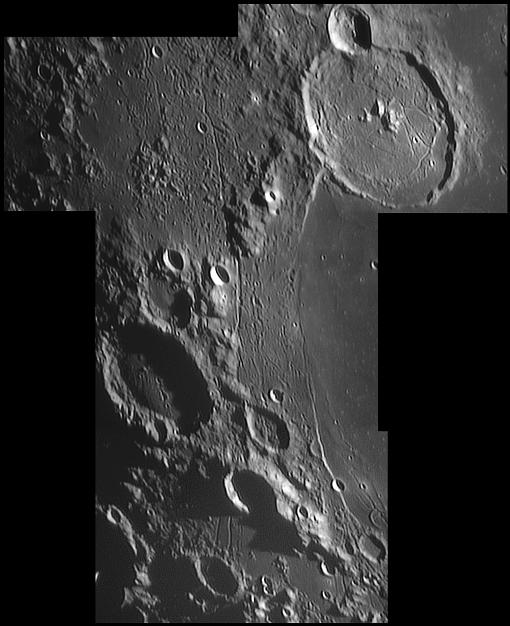
image by Maximilian Teodorescu, Dumitrana, Romania
In this superb image Max has captured the rilled region on the western side of Mare Humorum and in the terrain to the west. The abrupt boundary between the smooth mare floor and the rubbled terrain is stark. One basin rim is indicated by the range (named the Percy Mountains by Birt in the 19th Century) that curves between Gassendi, Mersenius and Liebig (and passes along the Kelvin Scarp on the southeast of the mare. A second basin rim is evident at the upper left corner of the mosaic, and the space between the two rims is a low zone with patches of mare and basin ejecta. The Liebig Rille is similar to the Bürg Rille II in that both start as faults and become rilles. The fault section of Liebig is remarkable in cutting through an unnamed crater, and dropping its east side down so that it is now covered by Humorum's lavas. The fault nature reappears at its north end where it is cut by the younger structure Gassendi. And notice that a section of the rille in the south cuts through what looks like a linear dome - this is probably an area where pyroclastics erupted, building the lips on either side of the rille.
Chuck Wood
Technical Details
February 6, 2009 17:46-19:00 U.T. 8" Newtonian reflector @F/30, Philips To U cam 740k, mosaic of 4 images each 1000 frames, seeing 4-7/10 (times of excellent seeing)
Related Links
Identify named craters using Rükl plates 51 & 52
Yesterday's LPOD: Happy B-Day, Galileo
Tomorrow's LPOD: New Data From Old Pics
COMMENTS?
Register, Log in, and join in the comments.


