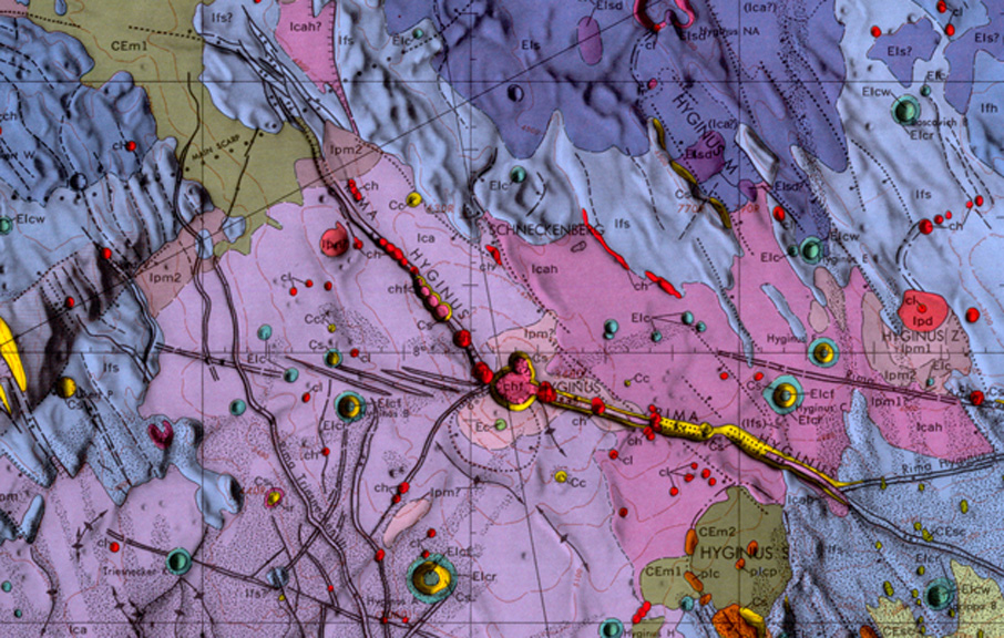
image from Mare Vaporum Quadrangle, made by Don Wilhelms, 1968.
Two days ago, before being wondrously interrupted by the newest Kaguya image, we investigated the Hyginus Rille using the spacecraft-like image from Wes Higgins. But we aren’t the first to look very carefully at this area. During the 1960s, US Geological Survey scientists mapped the lunar nearside, using telescopic photographs and actual observation at the eyepieces of moderate size telescopes. Mapping the entire Moon means that you have to depict and interpret every square kilometer of the surface. So in this map each color represents a unit with distinguishable characteristics. For example, south of Hyginus is a purplish-blue unit labeled Ica. The descriptive text says this is the Cayley Formation, which is smooth and flat. Cayley was interpreted as probably volcanic material, older and compositionally different from mare basalts. Today the Cayley is commonly interpreted as impact ejecta from Imbrium Basin. Although the interpetations of these map units may have changed over the last 40 years, the units themselves are real in the sense that they are documentably different than their neighbors. Each of the USGS mapped quadrangles is typically the most detailed study ever made of that piece of the Moon. As data come in from Kaguya and the other forthcoming lunar orbiters, these old maps will be the starting point for new interpretations. And the old maps are pleasant to work with because of their beauty.
Technical Details:
All the old geologic maps are available at the Lunar Planetary Institute Map Catalog.
Related Links:
Rükl plates 33 & 34
Yesterday's LPOD: Equal Rims?
Tomorrow's LPOD: Oblique Fireworks
COMMENTS?
Register, Log in, and join in the comments.


