|
image by Howard Fink
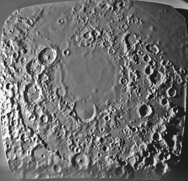
Howard transforms digital data sets of the Moon's topography into physical models that you can lovingly hold in you hands and rotate and tilt to see how features look from different perspectives and under different illumination angles. When LPOD previously featured Howard's model of the South Pole area I mentioned that I'd like to see a model of the Altai Scarp, and here it is. Based on LRO digital topography, this model nicely shows the Altai rim of the Nectaris Basin, and allows you to trace it eastward until it breaks up and is only hinted at by bits and pieces of ridges. Even less of the basin rim is visible to the north but the land is lower and less rugged south of where the ring should be than it is to the north. The middle ring that passes through Catharina and goes south of Fracastorius also becomes weaker and ultimately disappears.The ring that bounds Mare Nectaris is visible all around, as is the innermost mare ridge ring that shows up better in topography than in images. Thanks to Howard for satisfying my yearning to see this area of the Moon.
Chuck Wood
Technical Details
Vertical scale 4x horizontal, 1:4,000,000 scale
Related Links
21st Century Atlas chart B4.
Howard's website and model sales.
Yesterday's LPOD: Mauve and Gold
Tomorrow's LPOD: Seeping Out
Register, Log in,
and join in the comments.
|


