September 2, 2013
Rillomania

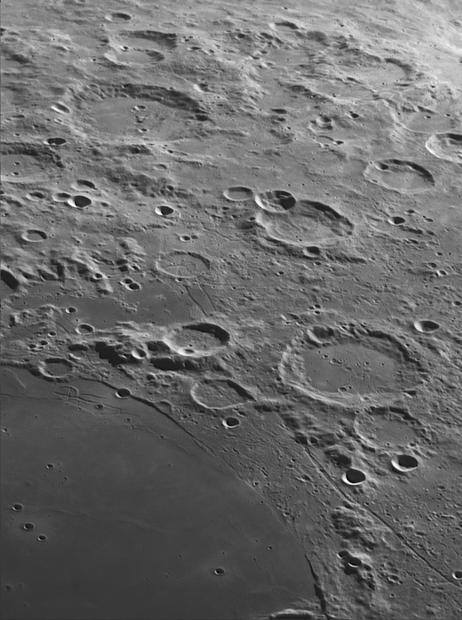
south up image by Jocelyn Serot, Clermont-Ferrand, France
An image showing, with a rather unusual point of view, the SW shore of M. Humorum and the area between Mersenius and Vieta. At the largest scale, the most noticeable feature is the contrast between three types of terrain : the smooth surface of M. Humorum, the hummocky terrain west of the mare and the transition area between Rupes Liebig and Rima Mersenius. Looking closer, the most striking feature is probably Rupes Liebig, whose "faulty" nature is obvious with these lightning conditions. The transition between the west-east slope near Liebig G and F and the area where the "wave" of lavas from Humorum seems to lap onto it is obvious. At the even smaller scale, the most prominent features are rilles, which are everywhere here : the large Mersenius Rille of course but also the strange pattern of the Doppelmayer Rilles just east of Liebig G (with the T shape within the burried crater). The complex network of rilles within Mersenius is just visible. Also the rilles around and inside De Gasparis (including the two parallel ones joining Liebig). And many more!
Jocelyn Serot
Technical Details
11" SCT @ F/D=19, R filter, Basler acA1300 camera. Processing : Autostakker2 + Registax6
Related Links
21st Century Atlas charts 23, 25 & 26.
An earlier view
Yesterday's LPOD: Thrice Battered
Tomorrow's LPOD: Too Dazzling for Morning Coffee?
COMMENTS?
Register, Log in, and join in the comments.


